


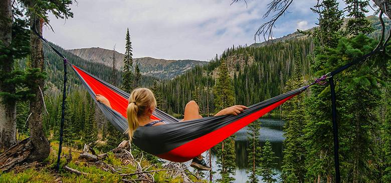
Kashmir Valley
From
Duration
Tour Type
Overview
The Kashmir region lies between latitudes 32° and 36° N, and longitudes 74° and 80° E. It has an area of 68,000 sq mi (180,000 km2).[44] It is bordered to the north and east by China (Xinjiang and Tibet), to the northwest by Afghanistan (Wakhan Corridor), to the west by Pakistan (Khyber Pakhtunkhwa and Punjab) and to the south by India (Himachal Pradesh and Punjab).[45]
The topography of Kashmir is mostly mountainous. It is traversed mainly by the Western Himalayas. The Himalayas terminate in the western boundary of Kashmir at Nanga Parbat. Kashmir is traversed by three rivers namely Indus, Jehlum and Chenab. These river basins divide the region into three valleys separated by high mountain ranges. The Indus valley forms the north and north-eastern portion of the region which include bare and desolate areas of Baltistan and Ladakh. The upper portion of the Jhelum valley forms the proper Vale of Kashmir surrounded by high mountain ranges. The Chenab valley forms the southern portion of the Kashmir region with its denuded hills towards the south. It includes almost all of the Jammu region. High altitude lakes are frequent at high elevations. Lower down in the Vale of Kashmir there are many freshwater lakes and large areas of swamplands which include Wular Lake, Dal Lake and Hokersar near Srinagar.[46]
To the north and northeast, beyond the Great Himalayas, the region is traversed by the Karakoram mountains. To the northwest lies the Hindu Kush mountain range. The upper Indus River separates the Himalayas from the Karakoram.[47] The Karakoram is the most heavily glaciated part of the world outside the polar regions. The Siachen Glacier at 76 km (47 mi) and the Biafo Glacier at 63 km (39 mi) rank as the world’s second and third longest glaciers outside the polar regions. Karakoram has four eight-thousander mountain peaks with K2, the second highest peak in the world at 8,611 m (28,251 ft).[48][49]
The Indus River system forms the drainage basin of the Kashmir region. The river enters the region in Ladakh at its southeastern corner from the Tibetan Plateau, and flows northwest to run a course through the entire Ladakh and Gilgit-Baltistan. Almost all the rivers originating in these region are part of the Indus river system.[50] After reaching the end of the Great Himalayan range, the Indus turns a corner and flows southwest into the Punjab plains. The Jhelum and Chenab rivers also follow a course roughly parallel to this, and join the Indus river in southern Punjab plains in Pakistan.
The geographical features of the Kashmir region differ considerably from one part to another. The lowest part of the region consists of the plains of Jammu at the southwestern corner, which continue into the plains of Punjab at an elevation of below 1000 feet. Mountains begin at 2000 feet, then raising to 3000–4000 feet in the “Outer Hills”, a rugged country with ridges and long narrow valleys. Next within the tract lie the Middle Mountains which are 8000–10,000 feet in height with ramifying valleys. Adjacent to these hills are the lofty Great Himalayan ranges (14000–15000 feet) which divide the drainage of the Chenab and Jehlum from that of the Indus. Beyond this range lies a wide tract of mountainous country of 17000–22000 feet in Ladakh and Baltistan.[44][clarification needed]
Climate
Kashmir has a different climate for every region owing to the great variation in altitude. The temperatures ranges from the tropical heat of the Punjab summer to the intensity of the cold which keeps the perpetual snow on the mountains. Jammu Division, excluding the upper parts of the Chenab Valley, features a humid subtropical climate. The Vale of Kashmir has a moderate climate. The Astore Valley and some parts of Gilgit-Baltistan features a semi-Tibetan climate. While as the other parts of Gilgit-Baltistan and Ladakh have Tibetan climate which is considered as almost rainless climate.[44][52]
The southwestern Kashmir which includes much of the Jammu province and Muzaffarabad falls within the reach of Indian monsoon. The Pir Panjal Range acts as an effective barrier and blocks these monsoon tracts from reaching the main Kashmir Valley and the Himalayan slopes. These areas of the region receive much of their precipitation from the wind currents of the Arabian Sea. The Himalayan slope and the Pir Panjal witness greatest snow melting from March until June. These variations in snow melt and rainfall have led to destructive inundations of the main valley. One instance of such Kashmir flood of a larger proportion is recorded in the 12th-century book Rajatarangini. A single cloudburst in July 1935 caused the upper Jehlum river level to rise 11 feet.[53] The 2014 Kashmir floods inundated the Kashmir city of Srinagar and submerged hundreds of other villages.[54]
Included/Exclude
- Pick and Drop Services
- 1 Meal Per Day
- Cruise Dinner & Music Event
- Visit 7 Best Places in the City With Group
- Additional Services
- Insurance
- Food & Drinks
- Tickets
Tour Plan
Location
Find a route from your location
Calendar & Price
General
General
General
General
General
General
General
General
General
General
General
General
General
General
General
General
General
General
General
General
General
General
General
General
General
General
General
General
General
General
General
General
General
General
General
General
General
General
General
General
General
General
General
General
General
General
General
General
General
General
General
General
General
General
General
General
General
General
General
General
General
General
General
General
General
General
General
General
General
General
General
General
General
General
General
General
General
General
General
General
General
General
General
General
General
General
General
General
General
General
General
General
General
General
General
General
General
General
General
General
General
General
General
General
General
General
General
General
General
General
General
General
General
General
General
General
General
General
General
General
General
General
General
General
General
General
General
General
General
General
General
General
General
General
General
General
General
General
General
General
General
General
General
General
General
General
General
General
General
General
General
General
General
General
General
General
General
General
General
General
General
General
General
General
General
General
General
General
General
General
General
General
General
General
General
General
General
General
General
General
General
General
General
General
General
General
General
General
General
General
General
General
General
General
General
General
General
General
General
General
General
General
General
General
General
General
General
General
General
General
General
General
General
General
General
General
General
General
General
General
General
General
General
General
General
General
General
General
General
General
General
General
General
General
General
General
General
General
Related Tours
Review Scores
3 thoughts on “Kashmir Valley”
Add a Comment Cancel reply
Booking Tour
Tour Information
Max Guests
Min Age
Tour Location
Languages Support
Last Minute Deals

Hungary
Singapore
4
We always stay at here when in town. The location is great, staff is wonderful and we love the overall feel. Beautiful view from the here.
3.4
This is the best tour on the east coast! It was amazing how many places we visited and what great memories we made!
4
It is a great place to shop not too far from New York. We took the bus from Port Authority and traveled through the countryside to get there.